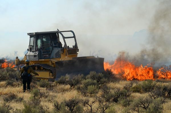
Invasive annual grasses, primarily Bromus tectorum, are a severe risk to native vegetation of the intermountain West. Once established, annual grasses alter natural fire regimes and outcompete natives until, in some places, they become the overwhelming dominant. We developed a regional spatial model encompassing eight ecoregions to indicate the relative abundance of invasive annual grass at five levels of canopy cover.
We used field sample data representing invasive annual grass abundance to build and calibrate the model. Explanatory variables, represented as map inputs, included image indices, climate, landform, soil, and human-induced surface disturbance. As a novel modeling approach, we built multiple models based on classes of invasive annual grass cover abundance were developed individually and then combined into a final 90-m pixel resolution model that indicates locations relative to invasive annual grass abundance into classes of < 5%, 5−15%, 16−25%, 26−45%, and > 45% cover. Each component model was validated using held-out sample data, and relative accuracy was 86%, 74%, 62%, 62%, and 60%, respectively, with an overall kappa of 0.773.
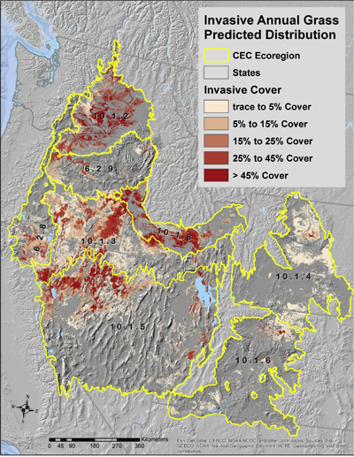 The Columbia Plateau, Northern Basin and Range, and Snake River Plain ecoregions appear to have the greatest overall proportions (48−62%) mapped within at least one of the invasive cover categories. Overlay of the resulting model with major vegetation types indicated > 50 major vegetation types that are affected by current distribution of annual grasses and are at risk of expansion. Among these, Intermountain Basins, Big Sagebrush Steppe, and Columbia Plateau Steppe and Grassland each consistently scored high for invasive risk where they occur.
Spatial models of this type should assist with rangeland restoration and for decisions involving placement of infrastructure, vegetation treatments where further surface disturbance could trigger additional cheatgrass expansion. Options exist for extending this model, using climate projections over upcoming decades, to indicate areas of increasing risk for invasion.